Existing and Emerging Markets
Geiger-mode lidar technology is best suited to applications requiring:
- rapid collection of detailed imagery
- collection from long distances
- compact systems with high collection rates
Wide-area 3D Mapping of Cities and Regions:
Today in the US there are approximately 100 airborne lidar systems in operation, collecting data for:
- Flood plain mapping
- Infrastructure monitoring
- Environmental monitoring
- 3D underlay for 2D imagery
- Forestry, construction, and mining
- Oil and mineral exploration
- Archeology
- and many more.
Timely Business Intelligence:
Decision makers are more efficient when they have an accurate and current operating picture. 3D lidar can help inform:
- Disaster relief and damage assessment, by enabling automated geometric change detection and trafficiability assessment
- Commodity pricing, based on better plant health assessments on a regional / national scale
- Forestry harvest practices, by measuring tree sizes and ground terrain profiles
- Pipeline and powerline corridor maintenance, by measuring vegetation height and incursion
- Law enforcement and border patrol, by imaging human activity under heavy canopy
Real-time 3D Scene Monitoring:
In the future, one can expect compact and power-efficient 3D sensors to be developed for use in:
- Autonomous navigation of airborne and ground-based vehicles
- Imaging through canopy from small UAVs at kilometer ranges
- Automated 3D object recognition from standoff
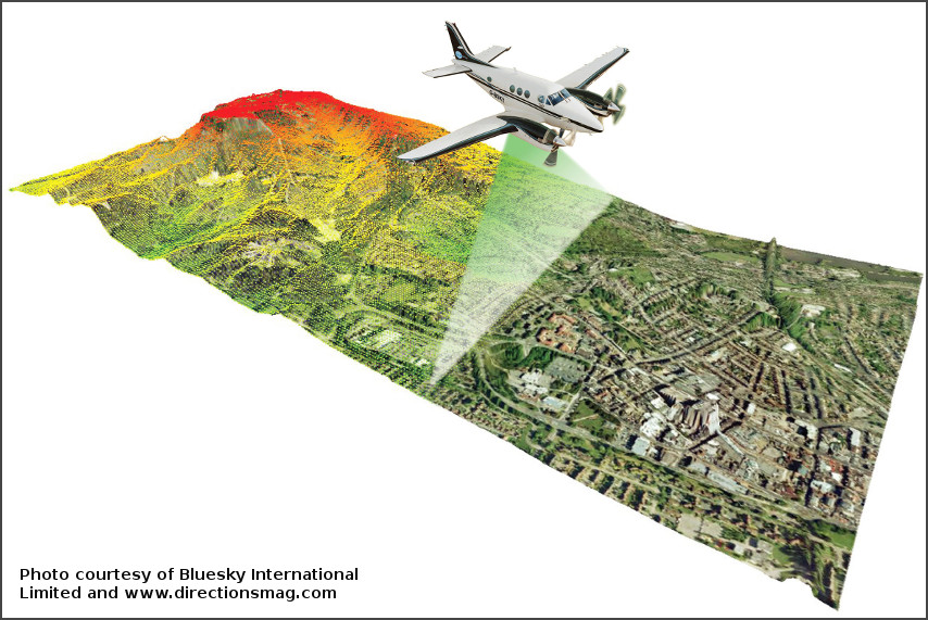
Wide-area 3D mapping is accomplished as the airborne lidar scans the ground while flying along. Accurate sensors onboard the aircraft measure its position and orientation; when combined with the laser rangefinder measurements an accurate, geolocated 3D image of the ground is obtained.
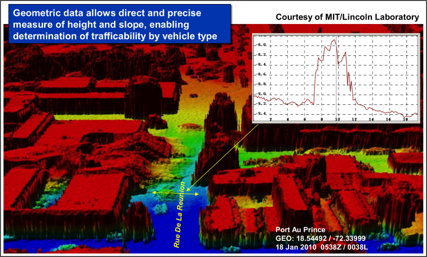
The ALIRT airborne lidar sensor was summoned to Haiti immediately after the disastrous earthquake in 2010. It rapidly mapped cities and towns, providing to the humanitarian assistance teams valuable information about where trucks could drive, where helicopters could land, what buildings were destroyed, where refugee camps were growing or shrinking, where the spring rains would flood vulnerable camps. The false-color image below shows the crumbling tax office and deep rubble blocking the street. The transect across the rubble, shown in the inset, indicates the depth of the debris.